Category Archives: Pictures

Space pictures

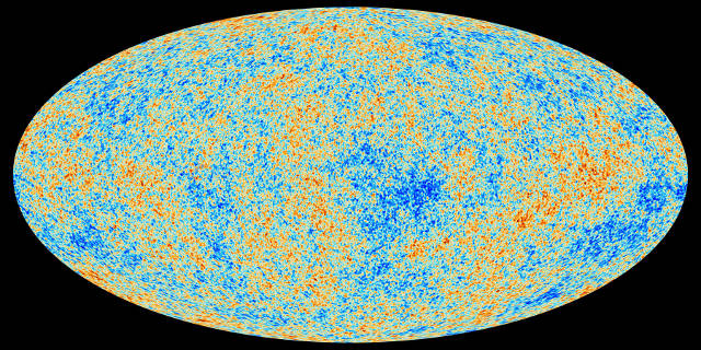
Map of the Universe

Isn’t the universe infinite in size or always expanding in size or of unknown size? Can the universe be mapped?
Universe - ESA
Map of the Universe generated by ESA’s Planck mission

Apparently it can be mapped! The European Space Agency’s Planck mission was launched in 2009 and comprised of a satellite housing a large telescope, which collected the light from the Cosmic Microwave Background (CMB). Placed in space from its L2 (Lagrangian) position, Planck’s mission was to “look back in time”. Data from Planck created this map of the universe showing the oldest light in our universe, as detected with the greatest precision yet. By analyzing these light patterns, scientists and researchers hope to learn more about origins of the universe.
Facebooktwitterredditlinkedintumblrmail

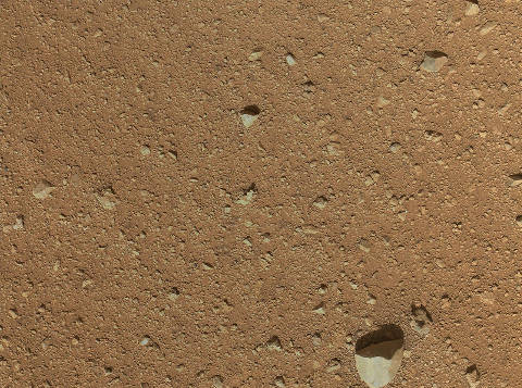
Martian dust and pebbles photographed by Curiosity

Martian Dust - NASA
Curiosity’s Mars Hand Lens Imager (MAHLI) took this picture of red Martian dust

This highly detailed image was taken by Curiosity rover’s Mars Hand Lens Imager (MAHLI) on September 8, 2012. On that day, which happened to be Curiosity’s 33rd day on Mars, its MAHLI dust cover was finally retracted and picture of the surface was taken. This patch of dusty Maritan ground is only about 34 inches across and the one large pebble,  near the bottom of the image, is about 3 inches in size. That area seems more pebbly than dusty leaving scientists to ponder the composition of the Martian surface, its wind patterns, etc.

Facebooktwitterredditlinkedintumblrmail

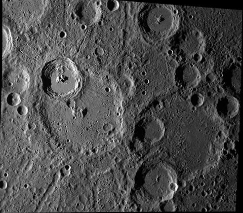
Kuiper crater on planet Mercury

Kuiper crater - NASA
NASA’s Messenger space probe photographed the Kuiper crater on planet Mercury

NASA in collaboration with CalTech, University of Arizona and Johns Hopkins University, manages the Messenger spacecraft whose mission was to be the first to orbit, explorer and study the innermost planet of our solar system, Mercury. This picture shows the 62 km wide crater Kuiper, photographed by Messenger’s wide angle camera. This is an important stratigraphic marker in Mercury’s geologic history as Kuiper and the surrounding area consists of rock that was melted by the impact with whatever it was, that created this crater.

Facebooktwitterredditlinkedintumblrmail

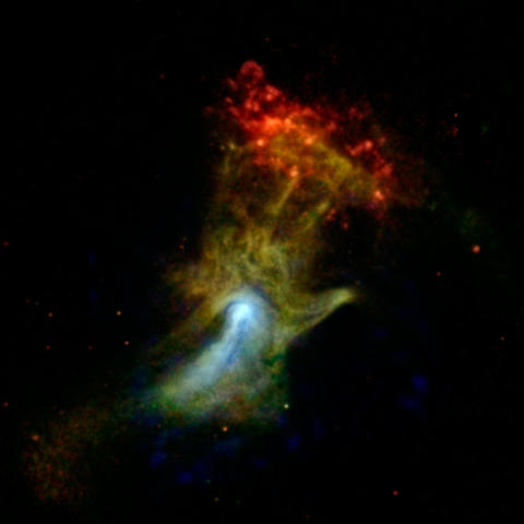
Pulsar wind nebula called the “Hand of God”

Pulsar wind nebula - NASA
X-ray image of a pulsar wind nebula called the “Hand of God”

This dramatic x-ray image is of a pulsar wind nebula, which is  powered by the leftover, dense core of a star that blew up in a supernova explosion. Electromagnetic radiation is being expelled and the interaction with magnetic fields creates a cloud that looks like an open hand. The actual pulsar is the smaller, highly magnetized white area in the picture  while the blueish portion is the structure of the high energy x-rays.  The red cloud at the end of the finger region is referred to as  RCW 89. NASA’s Nuclear Spectroscopic Telescope Array, or NuSTAR, was used along with the Chandra X-ray Observatory to compile this image.

Facebooktwitterredditlinkedintumblrmail

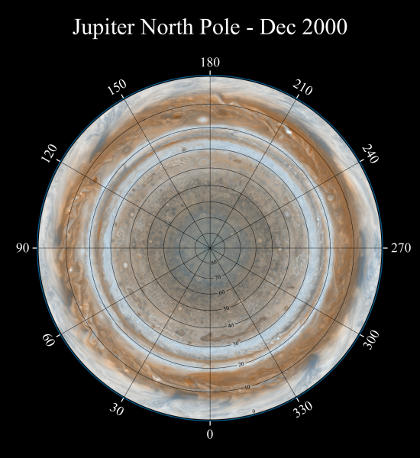
Jupiter’s North Pole

Jupiter North Pole - NASA
Composite picture of Jupiter’s north pole, compiled by the Cassini-Huygens mission

Cassini Orbiter spacecraft, which is a collaboration between NASA, the European Space Agency and Italian Space agency’s Cassini-Huygens mission, was used to come up with this composite view of Jupiter’s North Pole – while on its way to explore the planet Saturn and its moons. The onboard narrow-angle camera took numerous pictures over a period of two days in December 2000 and 36 of them were used to create this view, with a grid overlayed to divide the planet. The smallest visible features on this map are about 120 kilometers across and show a variety of colorful cloud features. The Great Red spot, the multi-coloured (red, brown and white) bands, and some small vortices are visible in this unique picture “looking down” on Jupiter.

Facebooktwitterredditlinkedintumblrmail