Category Archives: Pictures

Space pictures

Iceland volcano eruption

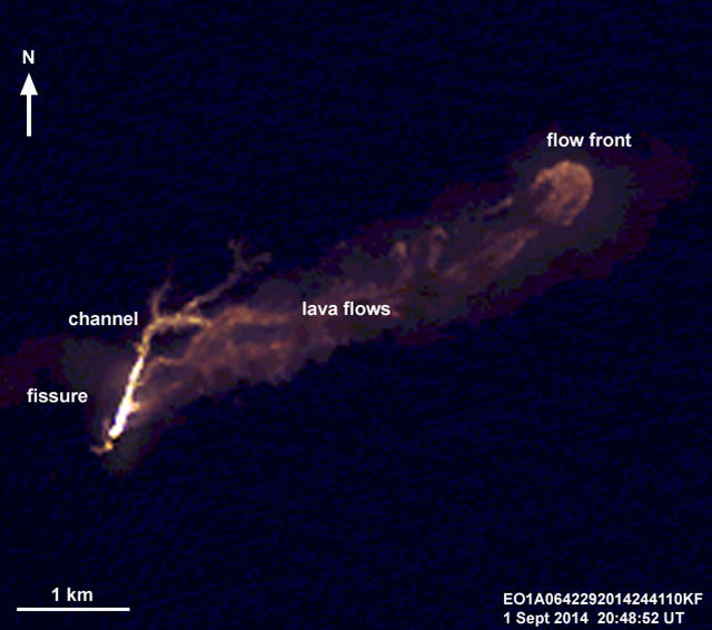
Advanced Land Imager captures volcanic eruption at Holuhraun, Iceland
Advanced Land Imager captures Iceland volcano eruption at Holuhraun island

The world has been following the volcanic eruptions in Iceland and the subsequent earthquakes and ash clouds that are likely to follow. These are both big concerns with the latter potentially having a significant impact to airline travel through large parts of the northern hemisphere.

On September 1st, the Advanced Land Imager (ALI) on NASA’s Earth Observing 1 (EO-1) spacecraft observed from orbit the eruption of the Bardarbunga volcano at Holuhraun, Iceland. This image captures the kilometer long fissure from which lava is erupting both a channeled and more expansive lava flows.
Facebooktwitterredditlinkedintumblrmail

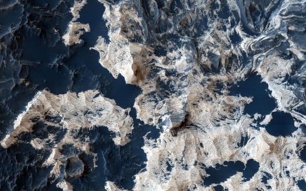
Schiaparelli Crater on Mars

Schiaparelli Crater - NASA
The many layers on the floor of the Schiaparelli Crater on Mars

NASA’s Mars Reconnaissance Orbiter (MRO) has been dutifully mapping and photographing the Mars surface since its arrival at the red planet in 2006. This picture shows the very shallow Schiaparelli Crater (named after Italian astronomer Giovanni Schiaparelli), which is a 460 kilometer (286 mile) wide structure on Mars. Most of the floor of the Schiaparelli crater is covered by a thin layer of dust, but in places where there are patches of dark sand, there is also well-exposed bedrock.

Facebooktwitterredditlinkedintumblrmail

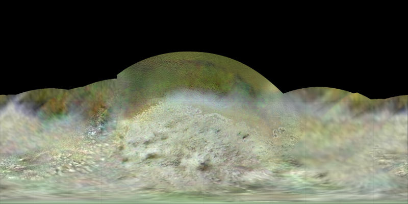
Map of Triton

Triton - NASA
Data from the Voyager 2 spacecraft was used to create this map of Triton

Dr. Paul Schenk, a scientist at the Lunar and Planetary Institute (which is part of the Universities Space Research Association research organization) in Houston created this map of Triton. He used data gathered by the Voyager 2 spacecraft as it had flown by Neptune’s moon Triton in 1989. This is considered to be one of the best mapping of Triton.

Facebooktwitterredditlinkedintumblrmail

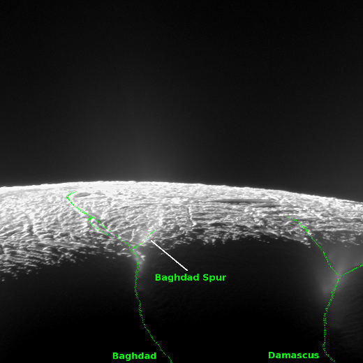
Enceladus’ South Pole

Enceladus - NASA
South pole region of Saturn’s moon, Enceladus

It must be a human tendency to name regions based on known areas on Earth, as Baghdad and Damascus show up on this depiction of the southern pole of Saturn’s moon – Enceladus. These Cassini survey images of the south pole, taken with Cassini’s narrow-angle camera,  look across the region of Enceladus’ geyser basin and down on the ends of the Baghdad and Damascus fractures that face Saturn. The  segments with these geysers with fractures seen in these images, are among the most active and warmest in the region

Facebooktwitterredditlinkedintumblrmail

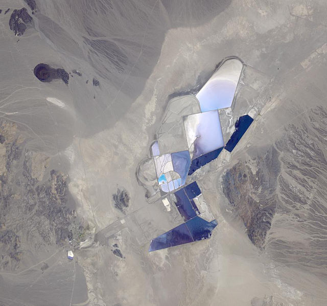
Lithium mining in Nevada

Lithium mining - NASA
Lithium mining in Nevada

The mobile phone revolution and the projected increase in hybrid-electric and electric cars/transportation has brought the chemical element lithium to the masses. This metal is a key component in high-powered consumer and industrial battery technology. NASA’s Terra Earth observation satellite took this picture of Rockwood Lithium’s mining operations located in the Clayton Valley of Nevada. This is one of the very few lithium mining operations in the United States.

Facebooktwitterredditlinkedintumblrmail