Tag Archives: mars

Tracing Curiosity’s recent trip on Mars

Curiosity rover takes a trip exploring the Pahrump Hills outcrop

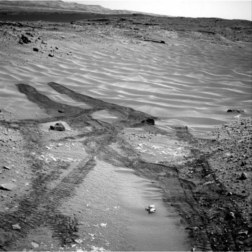
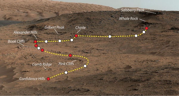
The Mars Curiosity rover has been pretty busy the last few years, checking out all kinds of sights and samples on Mars. This map shows the Pahrump Hills area that it was exploring during the September – October months of this year. Starting off at Confidence Hills, it drilled some samples for analysis and moved along the outcrop taking breaks (shown as red dots) along the way. The white dots represent areas where Curiosity stopped to take additional pictures and data of the Pahrump Hills outcrop. The mission ended in an area dubbed White Rock.

Facebooktwitterredditlinkedintumblrmail

MRO looking for debris fields on Mars

Mars Reconnaissance Observer has been scanning the surface for signs of previous failed missions debris
Mars Reconnaissance Observer (MRO) has been scanning the surface for signs of previous failed missions debris

The MRO was checking out what is believed to have been the planned landing site of the failed Soviet Mars Lander 3 mission. This probe was meant to land on Mars in 1971 but went silent after its crash (landing) as its descent stage is believed to have malfunctioned. Mars Lander 2 was successful with its soft landing but malfunctioned shortly after. The HiRISE system took this image to try and help find the location of the Mars Lander 2 and 3 probes or what may still be left of them as debris fields.

Facebooktwitterredditlinkedintumblrmail

Is this frost on Mars?

Mars Reconnaissance Orbiter finds possible signs of frost

In what is believed to be a first, the high resolution camera on-board the Mars Orbiter may have discovered frost on a non-polar region of the planet. While photographing a crater in the Northern Plains, it may have discovered a thin layer of bright frost on part of the crater’s wall. Since carbon dioxide is not stable under (Martian) summer conditions, this is likely a patch of water ice.

Facebooktwitterredditlinkedintumblrmail

Wdowiak Ridge on Mars

Rocky landscape of the Wdowiak Ridge photographed by the Opportunity rover

NASA’s Mars Exploration Rover Opportunity took this picture on its 3,786th Martian day on the planet. Taken with its panoramic camera, this approximate true color image shows the rocky terrain of the Wdowiak Ridge and the rover’s previous tracks on the right. This ridge is named after Opportunity science team member Thomas J. Wdowiak  who passed away in 2013. It stands on the western rim of Endeavour crater just west of the rim’s main crest line.

Facebooktwitterredditlinkedintumblrmail

Curiosity’s tracks in Hidden Valley

NASA
Curiosity rover photographs its tracks from “Hidden Valley” on Mars

These tracks on a familiar looking sandy surface aren’t from one of the many barren deserts on Earth but instead come to us from NASA’s Curiosity rover on Mars. The rover was looking down down a ramp it had previously come up, at the northeastern end of “Hidden Valley” on Mars. In the distance we can also see the slopes of Mount Sharp within the Gale Crater. The rover’s Navcam was used to photograph this south facing view on its 717th day on Mars.

Facebooktwitterredditlinkedintumblrmail