Tag Archives: mars

Lunokhod crater on Mars

Lunokhod Crater - NASA
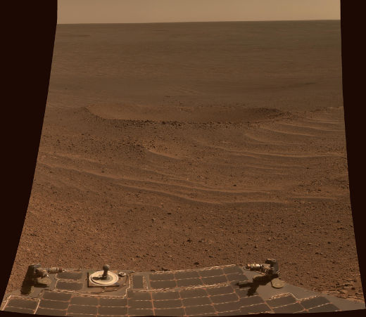
Opportunity rover explores the Lunokhod 2 crater on Mars

The panoramic camera on NASA’s Mars Exploration Rover took this picture of the 20 feet wide Lunokhod 2 crater. The Opportunity Rover approaches this area which is in the western rim of Endeavour Crater. Along with the now familiar reddish-brown, desert like Martian landscape, we can also see the rover’s rear solar arrays and a calibration target used to tweak its panoramic camera. This picture was taken on April 24, 2014 which was Opportunity’s 3,644th Martian day of exploration. This exploratory drive and every one since then, see Opportunity make new records for the longest travel on wheels on a celestial word, other than Earth. It surpassed the Soviet Union’s Lunokhod 2 rover’s exploits on our Moon.
Facebooktwitterredditlinkedintumblrmail

Eridania Basin on Mars

Eridania Basin - NASA
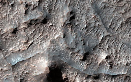
Ridges in Eridania Basin on Mars

The Mars Reconnaissance Orbiter has been diligently mapping the martian terrain for many years. Here the HiRISE instrument on the MRO photographed the Eridania Basin, located at the head of Ma’adim Vallis, may have been the site of an ancient inland sea on Mars with some interesting geological and mineral evidence supporting this thesis. Further assumptions may be made regarding the weather on ancient Mars and whether the conditions were right for life to have existed on the red planet.

Facebooktwitterredditlinkedintumblrmail

Hills of Arabia Terra

Arabia Terra - NASA
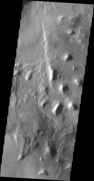
Hills of Arabia Terra on Mars

The 2001 Mars Odyssey mission craft took this picture of hills in the Arabia Terra region of Mars. This formation is located near the northern part of Mars. The NASA space craft used its on-board Thermal Emission Imaging System (THEMIS)  which is jointly managed with Arizona State University’s School of Earth and Space Exploration, to take this picture of the Martian landscape. It features numerous hills within an unnamed depression in the northern Arabia Terra region of Mars.

Facebooktwitterredditlinkedintumblrmail

Martian gully

Martian gully - NASA
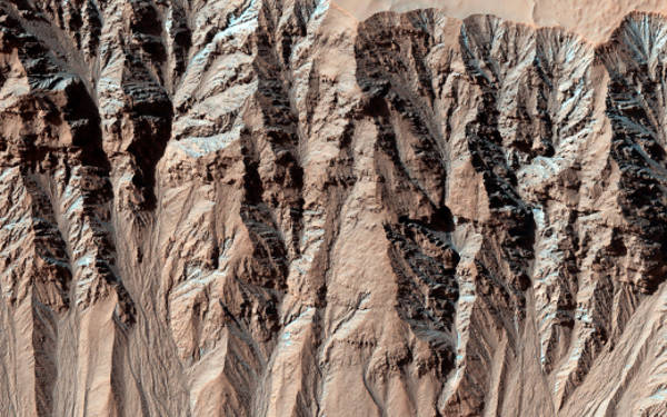
Gullies photographed by the Mars Reconnaissance Orbiter

The Mars Reconnaissance Orbiter’s (MRO) high resolution imaging camera (HiRISE) photographed these gullies on Mars to compare them to previous instances. Scientists from NASA and the University of Arizona have been studying this data and have found changes in many gullies on Mars showing the constant evolution of the various Martian landforms. Changes often occur in winter or early spring, suggesting that they may be caused by the carbon dioxide frost that forms in and around most of these Martian gullies every year.

Facebooktwitterredditlinkedintumblrmail

Dust storms on Mars

Mars Dust - NASA
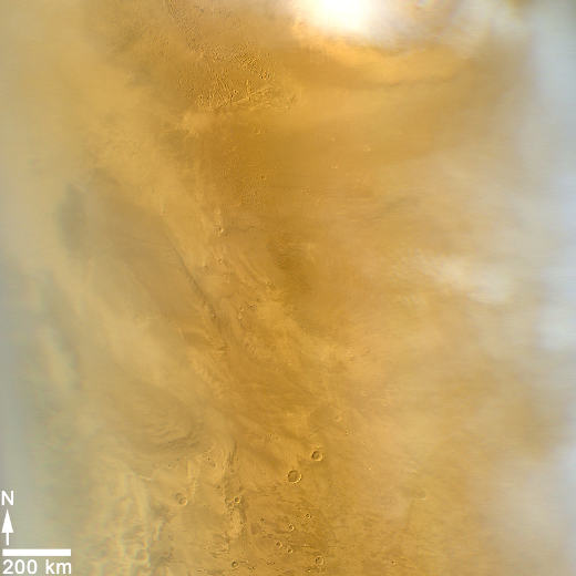
NASA’s Mars Reconnaissance Orbiter photographs the dusty martian atmosphere

This picture was taken by the Mars Color Imager (MARCI) camera on NASA’s Mars Reconnaissance Orbiter and covers an area about 1,000 miles (1,600 kilometers) wide on the Maritian surface. The atmosphere of the red planet seems to be experiencing dust storms when this particular weather related observation of Mars was made on March 20, 2014.

Facebooktwitterredditlinkedintumblrmail