NASA’s Earth Observing-1 satellite captured the “Super Pit” gold mine while making a pass over Kalgoorlie in Western Australia
Gold is a metal that has several unique properties and has long held a special place in human society. Whether its origins lie in supernova nucleosynthesis or the collision of neutron stars, gold has been associated with value due to its rarity, malleability, resistance to corrosion, pleasing colour and specialized industrial applications. Gold’s symbol is Au and its atomic number is 79.
The Advanced Land Imager on NASA’s Earth Observing-1 took this picture of the “Super Pit” gold mine near the town of Kalgoorlie which lies in the semi-arid region that is Western Australia. This open pit gold mine is a joint venture between Barrick Gold and Newmont mining. It produces approximately 850,000 ounces (28 tonnes) of gold per year.
The blue dot is pulsar PSR J1640-4631 from the inner Milky Way galaxy
NASA’s Nuclear Spectroscopic Telescope Array (NuSTAR) was able to discover this pulsar (PSR J1640-4631) by picking up the rotating beam of X-rays that were originating from its blue center. This pulsar lies in our inner Milky Way galaxy about 42,000 light-years away and its X-rays intersect Earth every 0.2 seconds. While the blue dot in this image marks the spot of this high energy pulsar (3 to 79 kiloelectron volts), the pink dots in this picture show low-energy X-rays (0.5 to 10 kiloeletron volts) detected by NASA’s Chandra X-ray Observatory.
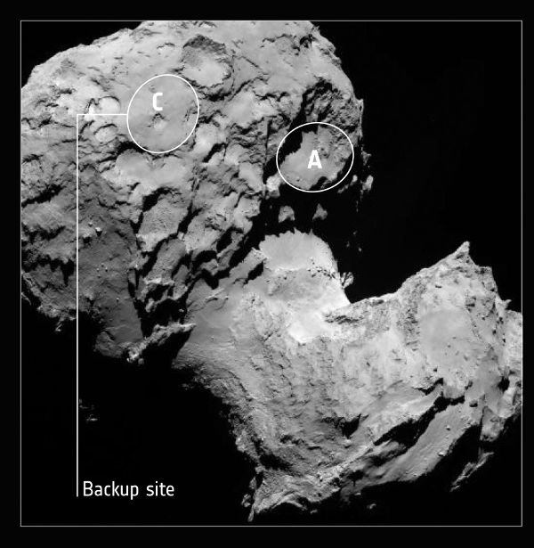
Backup landing site selected by the ESA for Rosetta mission
The European Space Agency has narrowed down their original ten landing sites for the Rosetta mission on comet 67P/Churyumov-Gerasimenko, down to five final landing sites (A, B, C, I and J). Landing site C was chosen as a backup site for Philae’s planned November 11, 2014 landing over the other potential landing sites because it had a higher level of illumination and fewer boulders.
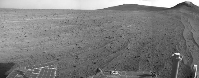
Mars Exploration Rover Opportunity captures the Martian landscape
The Mars Exploration Rover Opportunity’s navigation camera (Navcam) took this picture of the martian landscape on the 3,749th day of the rover’s mission on Mars. This south looking picture nicely captures windblown lines of sand on the surface and the western ridge of Endeavour Crater. On this day’s drive, the rover covered 338 feet along the outer slope of the crater’s rim.
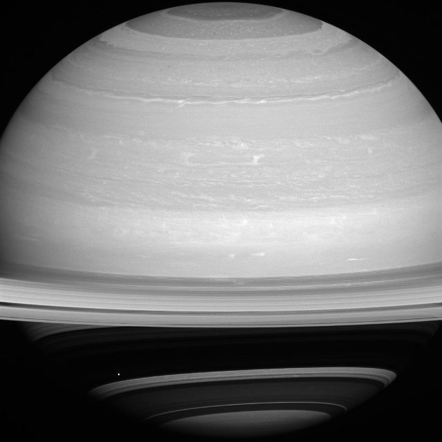
It may be hard to spot it, but the tiny white dot in the lower right part of the photo is Mimas, one of Saturn’s moons. Discovered by William Herschel in 1789, Mimas is named after the son of Gaia in Greek mythology. The Cassini Orbiter took this picture using its wide angle camera at a distance of over a million miles. And the bright speck that is Mimas just happened to be perfectly positioned against the shadow of Saturn’s rings. This view looks toward the sunlit side of the rings from about 10 degrees above the ringplane.
Exploring planets, stars, galaxies, astronomy, the universe and space secrets